Critical Mapping of the Beirut Blast Damage Assessments and Repair Efforts
The Beirut Urban Lab’s GIS team worked collaboratively with the Maroun Semaan Faculty of Engineering and Architecture (MSFEA), Rice University’s Spatial Studies Lab, the New Levant Initiative, and Open Map Lebanon. The Spatial Studies Lab put online a first damage assessment map that refined NASA’s satellite imagery on the basis of the BUL/LNSCR base map.
×
Immediately after the Beirut Port Explosion that occurred on August 4th 2020, the Beirut Urban Lab (BUL) identified the importance of streamlining and coordinating needs and damage assessments. Given the multiplicity of actors involved and the lack of predesigned strategy, the first effort was to unify the platform on which data was being collected.
×
To this end, the Beirut Urban Lab team made available online to download the geo-referenced base map of Beirut that it had developed in partnership with the Lebanese National Council for Scientific Research. During the following weeks, the map was widely used for surveys by several stakeholders, including the Lebanese Army’s Forward Emergency Room. The map was used to conduct the damage survey of the Order of Engineers and Architects (OEA), and several other NGOs, INGOs, and contractors working for post-disaster assessments.
The next task was to support the exchange of information about disaster assessments. Accordingly, the Beirut Urban Lab’s GIS team worked collaboratively with the Maroun Semaan Faculty of Engineering and Architecture (MSFEA), Rice University’s Spatial Studies Lab, the New Levant Initiative, and Open Map Lebanon. The Spatial Studies Lab put online a first damage assessment map that refined NASA’s satellite imagery on the basis of the BUL/LNSCR base map. It helped portray the extent of the damage and the ongoing repair works.
The next task was to support the exchange of information about disaster assessments. Accordingly, the Beirut Urban Lab’s GIS team worked collaboratively with the Maroun Semaan Faculty of Engineering and Architecture (MSFEA), Rice University’s Spatial Studies Lab, the New Levant Initiative, and Open Map Lebanon. The Spatial Studies Lab put online a first damage assessment map that refined NASA’s satellite imagery on the basis of the BUL/LNSCR base map. It helped portray the extent of the damage and the ongoing repair works.
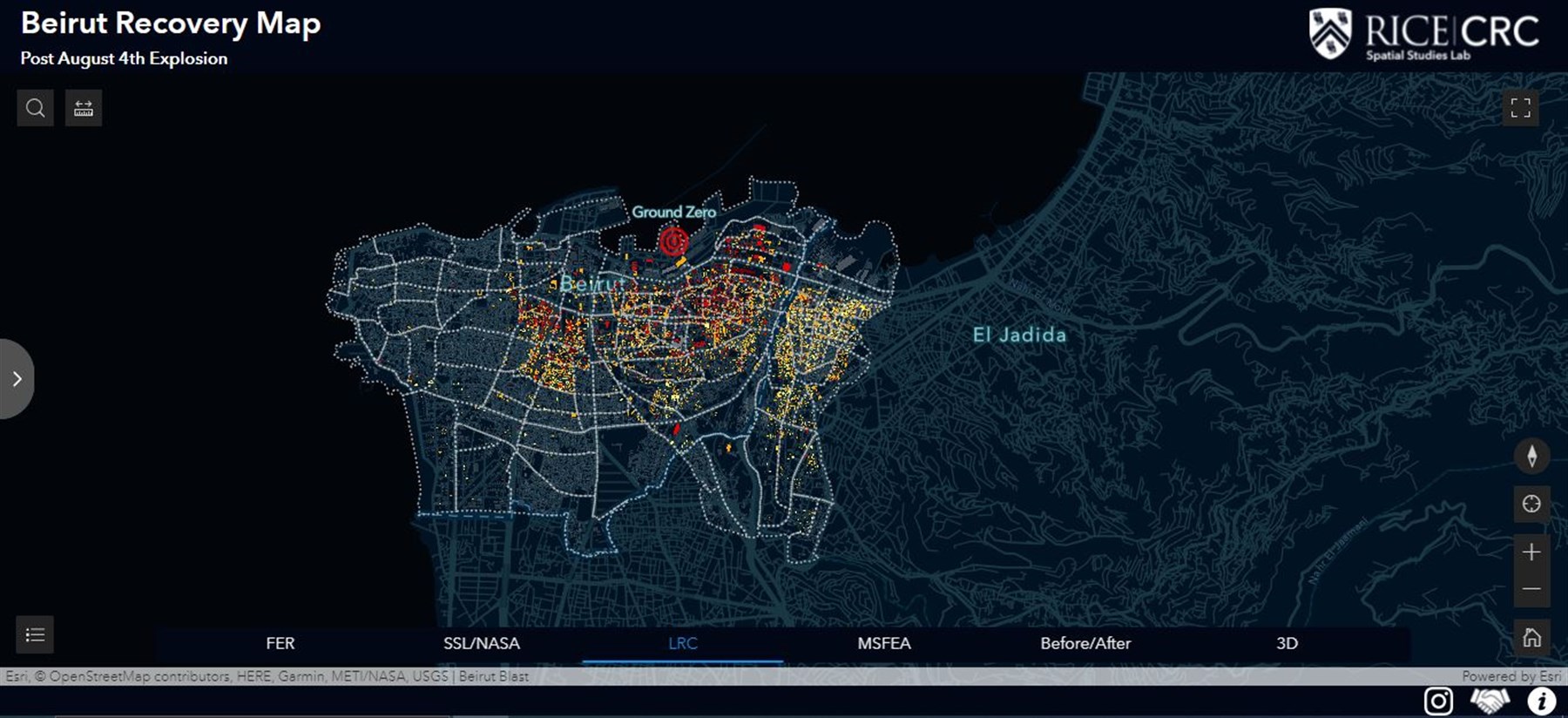

A first damage assessment map based on the BUL/LNSCR base map visualizing the extent of damage and ongoing repair works after Beirut August 4th blast.
×
During the months after the blast, the Beirut Urban Lab’s GIS Team also supported the damage surveys of the Order of Engineers and Architects (OEA) and AUB’s MSFEA Post-Disaster Building Structure Safety Hotline, producing regular updates and damage assessments of the neighborhoods affected by the blast.
Beirut Urban Lab is now reaching out to NGOs/INGOs to consolidate the data collected in the Observatory of the Beirut Urban Lab, in view of sharing it online publicly.
Beirut Urban Lab is now reaching out to NGOs/INGOs to consolidate the data collected in the Observatory of the Beirut Urban Lab, in view of sharing it online publicly.