Mapping NGOs Repairs

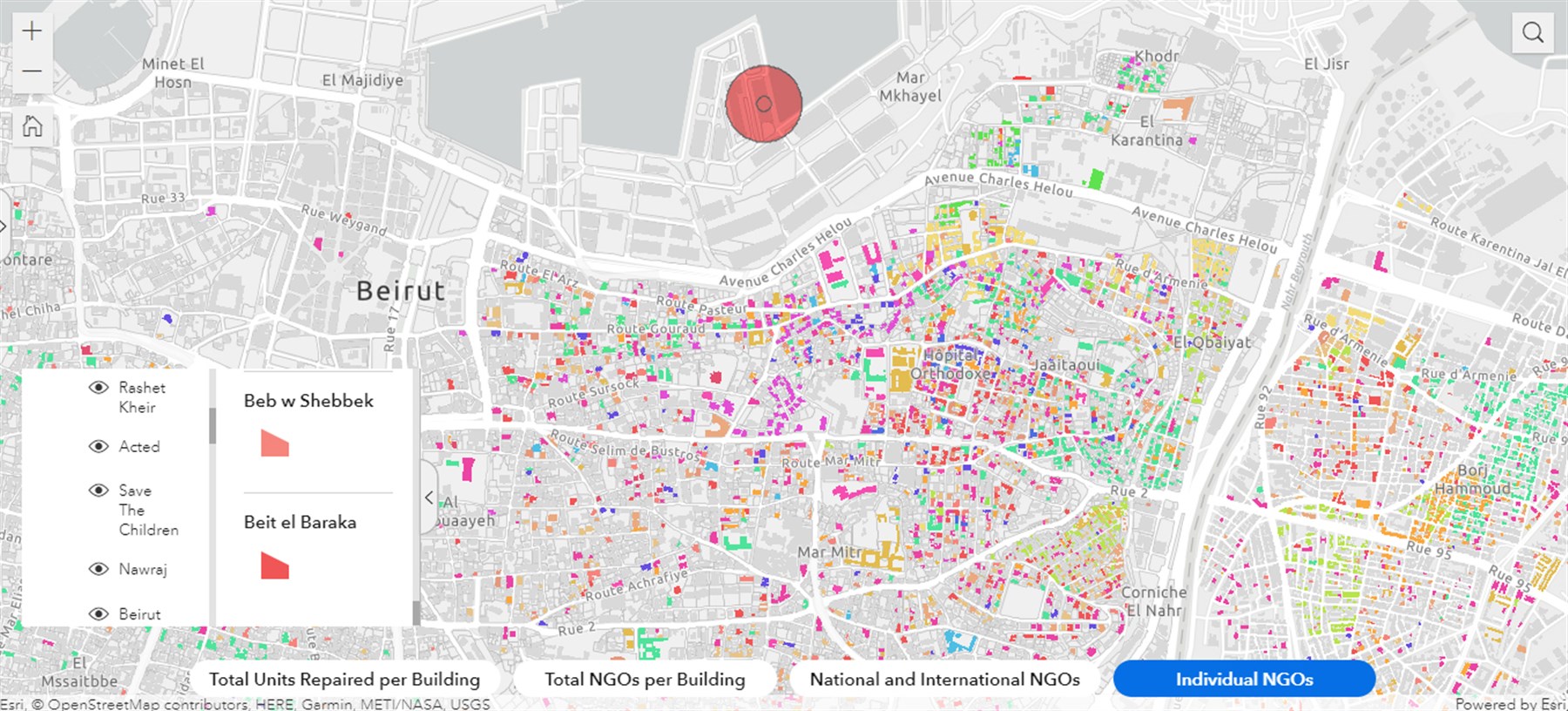
Map displaying where NGOs conducted post-blast repair works in Beirut
Between March and September 2021, BUL researchers identified around 80 NGOs that participated in shelter repair within the neighborhoods severely affected by the August 2020 port blast. The data and findings are presented through a recent mapping output on the Beirut Urban Observatory.
×
These organizations include national and international non-governmental organizations (NGOs), which can be seen as distinct layers on the map. These range between well-established organizations that have operated for decades and other actors that formed coalitions in the aftermath of the blast. Our initial reading of the data shows that NGOs largely led the response to the blast in Beirut’s neighborhoods.
×
Intervening without a comprehensive or integrated approach, each organization articulated a strategy for approaching shelter repair in accordance with internal criteria and/or parameters dictated by their donors. Consequently, their interventions reflected wide divergences in the standards they adopted and the modalities they developed. The research team reached out to most of these organizations for an interview and a request for data sharing. The output collects and visualizes the anonymized data shared by a number of actors related to the location of their interventions, which formed the base information for this mapping that we continue to expand as more NGOs provide us with data. The interviews covered three main issues: (i) how NGOs defined “repair”, (ii) the modalities of repair they adopted, and (iii) the constraints they faced while conducting the work. The research component of this project of the Beirut Urban Observatory seeks to identify and compare modalities of repair. It also geo-localizes the data obtained from NGOs, showing their geographic distribution and identifying concentration areas and zones relatively left out of repair interventions. We can thus show how and where each organization repaired units, compare NGOs’ categories, identify buildings and blocks with significant NGO presence, and visualize the scale of repair operations as well as the extent of the blast’s radius within the city.